Placeholder
Alert here

Create an Account

Some text here

Import Trip Plans

You or someone using this computer or device previously created Trip Plans.
What should we do with these plans?
Make these Trip Plans part of my account
Discard these Trip Plans

Login

Some text here

Password Reset

Please enter the email you used to set up your account.
We'll send a link to use to reset your password.

Check Your Email

If there is an account with the email address , we will send you a link to reset your password
La Sal Mountains

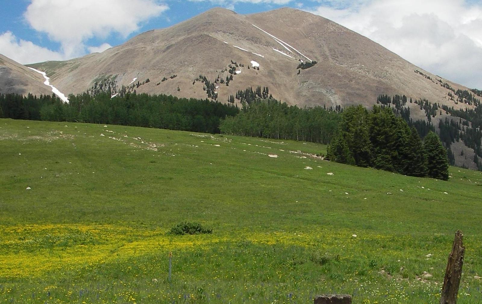
The La Sal Mountains are located twenty miles south of Moab. Part of the Rocky Mountains and Manti-La Sal National Forest, they are Utah’s second highest mountain range. More than a dozen mountains in the range have peaks above 12,000 feet, with Mount Peale the highest at 12,721 feet.

The La Sal Mountains reside on the Colorado Plateau along with the Abajo and Henry mountain ranges. All three ranges are roughly 25 million years old, significantly younger than nearby ranges, and were formed by igneous rocks and the erosion of sedimentary rocks from the Permian and Cretaceous periods. The La Sal Mountains are named for the Spanish word for salt.


The compact range is only 15 miles long and six miles wide, but outdoor enthusiasts head to the La Sals year-round for sightseeing, hiking, biking, off-roading, camping, photography, trout fishing and more. The La Sal Mountain Loop Road (FR-062) is a great way to explore the range. The 60-mile paved scenic loop begins six miles south of Moab on U.S. Highway 191, traversing the timbered mountains with expansive views of the red rock desert below and mountain peaks above. Changes in flora reflect the altitude, climbing past pinyon and juniper trees to Ponderosa pines and quaking aspens, with spruce and fir trees at the highest elevations. La Sal Mountain Loop Road loops from Moab to Castle Valley, Geyser Pass, and back again. Tight turns near Castle Valley may prove difficult for large RVs to maneuver. There are several overlooks and spur roads along the loop that lead to pretty lakes and off-road trails. Geyser Pass Road leads to Oowah Lake for excellent trout fishing, and a five-mile graded dirt road leads to popular Warner Lake. The La Sal Mountain Loop Road loops back to Moab shortly after the Warner Lake Turnoff.

Nearby Lodging Options


Loading...

Opening in a new tab...