Placeholder
Alert here

Create an Account

Some text here

Import Trip Plans

You or someone using this computer or device previously created Trip Plans.
What should we do with these plans?
Make these Trip Plans part of my account
Discard these Trip Plans

Login

Some text here

Password Reset

Please enter the email you used to set up your account.
We'll send a link to use to reset your password.

Check Your Email

If there is an account with the email address , we will send you a link to reset your password
Mexican Hat/Halchita

Elevation
4,244 feet (1,294 meters)

Population (Mexican Hat)
110

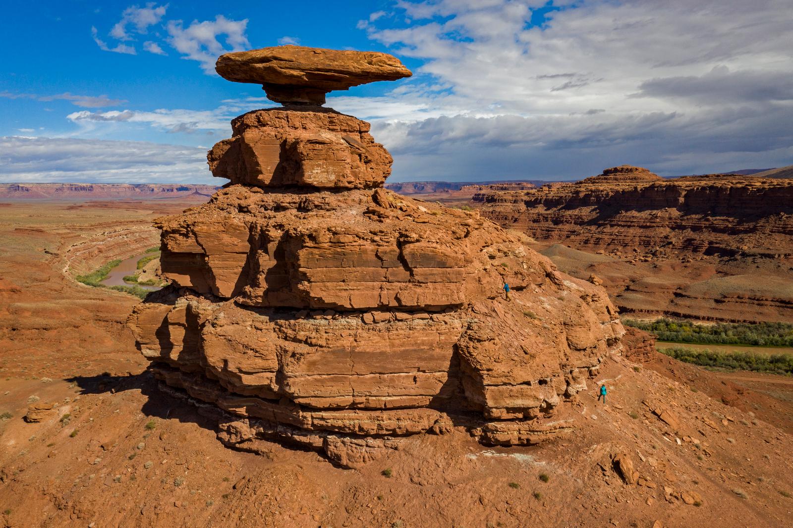
Named for the inverted stone sombrero near the town, Mexican Hat boasts a colorful history. Early in the last century over one thousand people at a time descended on this curve of the San Juan River looking for gold, oil, or uranium.

Today, the town is a popular starting point for adventures on the San Juan River. The Navajo Tapestry wavy geometric colors in the rock — strata — makes a colorful backdrop to the desert landscape. Halchita, a Navajo word meaning 'the red lands' is across the river.


Popular day tours include Grand Gulch Primitive Area, John's and Slickhorn Canyons, Goosenecks State Park, Valley of the Gods, Natural Bridges, Hovenweep, Navajo National Monuments, and Monument Valley Navajo Tribal Park. Full services available in Mexican Hat, none in Halchita.

Halchita is a small community situated near the San Juan River at 4350 feet along US 163. Mexican Hat is located on the north bank of the San Juan River. Halchita, a Navajo word meaning 'the red lands,' is located on the south bank. These communities are approximately twenty miles south of Bluff on US 163. Halchita is the first community encountered on the Reservation when traveling southbound on US 163. It is the location of a government remediated uranium millsite. Combined estimated population of Halchita and Mexican Hat in 2000 was 110.


Loading...

Opening in a new tab...